Golden Sidewalk Project

Overview
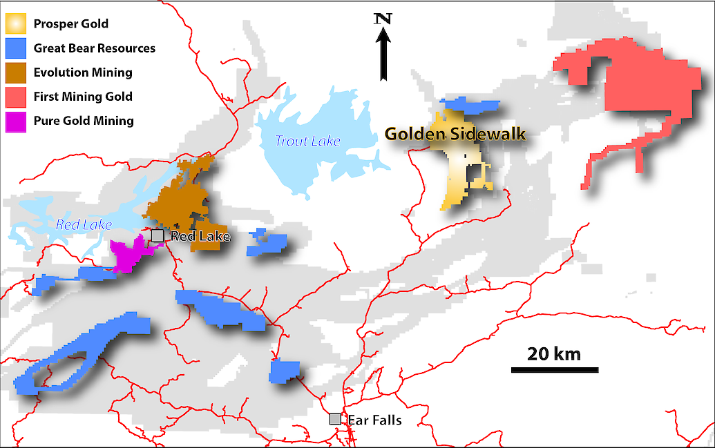
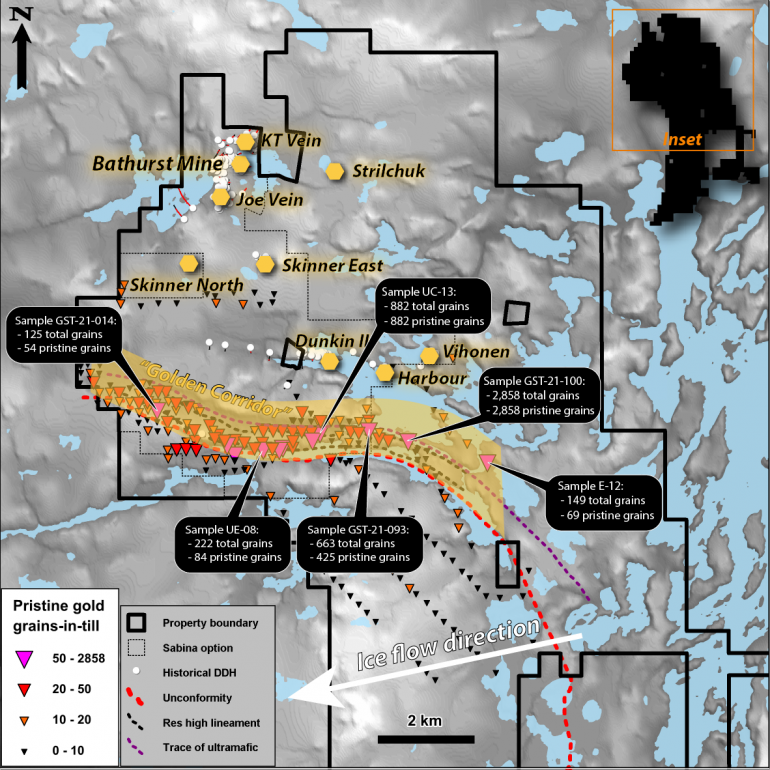
The Golden Sidewalk is a district-scale gold exploration project covering over 160 square kilometres of contiguous mineral claims and mining leases in the western Birch-Uchi Greenstone Belt, approximately 60 km east of Red Lake, Ontario. The vehicle-accessible project straddles 12 kilometres of the Balmer Assemblage – Narrow Lake Assemblage unconformity, a regional-scale feature that has been the Red Lake exploration guide, but which has seen limited exploration in the project area. The recently identified “Golden Corridor” lies immediately north of the unconformity in the western portion of the property and is characterized as a highly prospective, greater than 5 kilometre trend of coincident favourable magnetic and resistivity lineaments supported by highly anomalous gold-in-till samples covering 3.3 by 0.5 kilometres. Historical drilling programs at the Bathurst Mine, Joe Vein, KT vein, Dunkin and Vihonen prospects reported high-grade gold intercepts which warrant follow-up.
Geology
The Project is situated on the western side of the Birch-Uchi greenstone belt which, along with the Red Lake Greenstone Belt to the west, forms part of the Uchi Subprovince of the Superior Structural Province. The Project area is underlain by 2.99 Ma Balmer assemblage intermediate to mafic volcanics which are unconformably overlain by the Narrow Lake assemblage (2.97 – 2.87 Ma) mafic volcanics intruded by mafic and ultramafic sills. The Narrow Lake assemblage is in turn unconformably overlain by 2.87 Ma felsic and mafic volcanics of the Woman assemblage to the east. The above assemblages have been intruded by felsic to intermediate dikes associated with D1 and D2 deformational events. The Trout Lake Batholith contacts the volcanic units on the western side of the Project.
Mineralization
The nature of gold mineralization observed at the Golden Sidewalk project is typical of most archean-aged orogenic greenstone-hosted gold deposits in Ontario, whereby gold mineralization is hosted in quartz carbonate veins and volcanic wallrock, with proximal silica ± biotite-chlorite alteration and distal carbonate alteration. In the northern portion of the Project exists the historically producing Bathurst Mine, which was a high-grade, relatively small operation that began in the late 1920’s and persisted into the mid to late 1930’s. High grade ore shoots containing pyrite-arsenopyrite and visible gold historically exploited typically exhibited a spatial relationship with WNW-trending feldspar porphyry dikes within the Narrow Lake mafic volcanics. A similar spatial relationship exists at the KT Vein 500 metres north of the Bathurst mine site. Nine historical prospects hosting gold mineralization exist on the Property, seven of which have seen drilling with positive results.
Targets

The Project is host to several advanced exploration targets that have seen varying amounts of historical work. The most recent drilling completed was in 2008 along the Bathurst Mine trend, with intercepts up to 1.7 metres grading 46.0 g/t gold in diamond drill hole SGS-08-45. Drill indicated vein systems at the Joe Vein, KT vein and Bathurst Mine trend remain open for expansion down-plunge and along strike.
Several regional targets have recently been defined by Prosper Gold, most notably the Golden Corridor in the central portion of the Project. The Golden Corridor is characterized as a multi-parameter geophysical anomaly near a regional unconformity that serves as a major structural corridor. Based on till sampling results achieved late in the 2020 exploration season, the prospective geophysical and geological characteristics are underpinned by a 3,300 by 500 metre pristine gold grain-in-till anomaly with samples containing up to 882 pristine gold grains that is open for expansion.
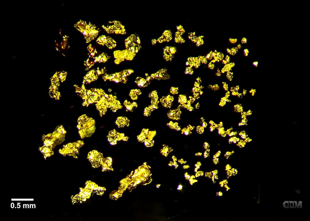
Photomicrograph of isolated gold grains from Golden Corridor Infill Till Samples. (Sample UC-13. Note scale bar in lower left.)

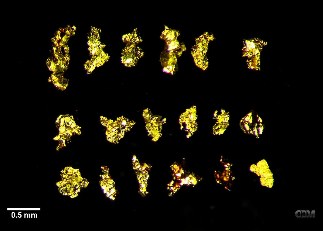
Photomicrograph of isolated gold grains from Golden Corridor Infill Till Samples. (Sample UC-13. Note scale bar in lower left.)

